( If you haven't read Part one you can find it here)
The night at Vogel State park was uneventful. I slept about as good as I ever do when I'm outside - which basically means I slept like crap. The night was cold and I was fine as long as my sleeping bag was zipped up completely around me but for much of the night it was a bit drafty. I never checked the temperature but if i were to guess I'd say it got down to the mid 30s.
I crawled out of my tent, stoked the fire, and started a breakfast of grits and coffee. We generally keep breakfast pretty simple to avoid a lot of clean up. It was still brisk and the air smelled of rain so I prodded the girls awake so we could break camp before it came.
My senses were correct. The rain came in just as we rolled out of the campsite and the timing could not have been better. We stopped by the visitors center to pay our site fee and grab a few souvenirs and once again we were back on the road. Today's 'plan' was much like the previous day's ... to continue east along the Georgia Traverse and see what happens.
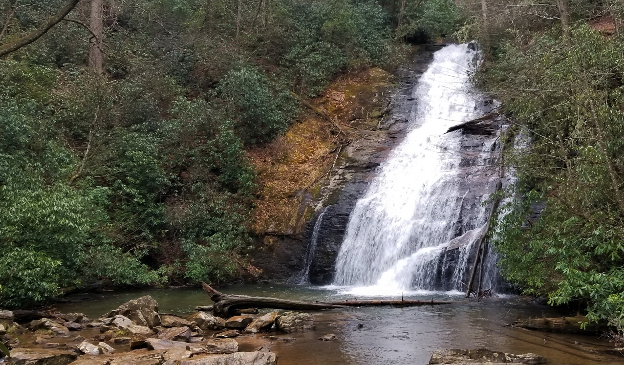
Departing from Vogel we soon turned onto Helton Creek Road. As we meandered along the path we caught our first glimpse of Helton Creek Falls - a beautiful multi-tier waterfall. The rain had let up so we pulled into the designated parking area at the trailhead and set off on the quarter mile hike to the falls. A warning sign at the start of the trail reads "DANGER! SERIOUS INJURY AND DEATH HAVE OCCURRED HERE. DO NOT BECOME THE NEXT VICTIM!" That's no bullshit sign if i've ever seen one.
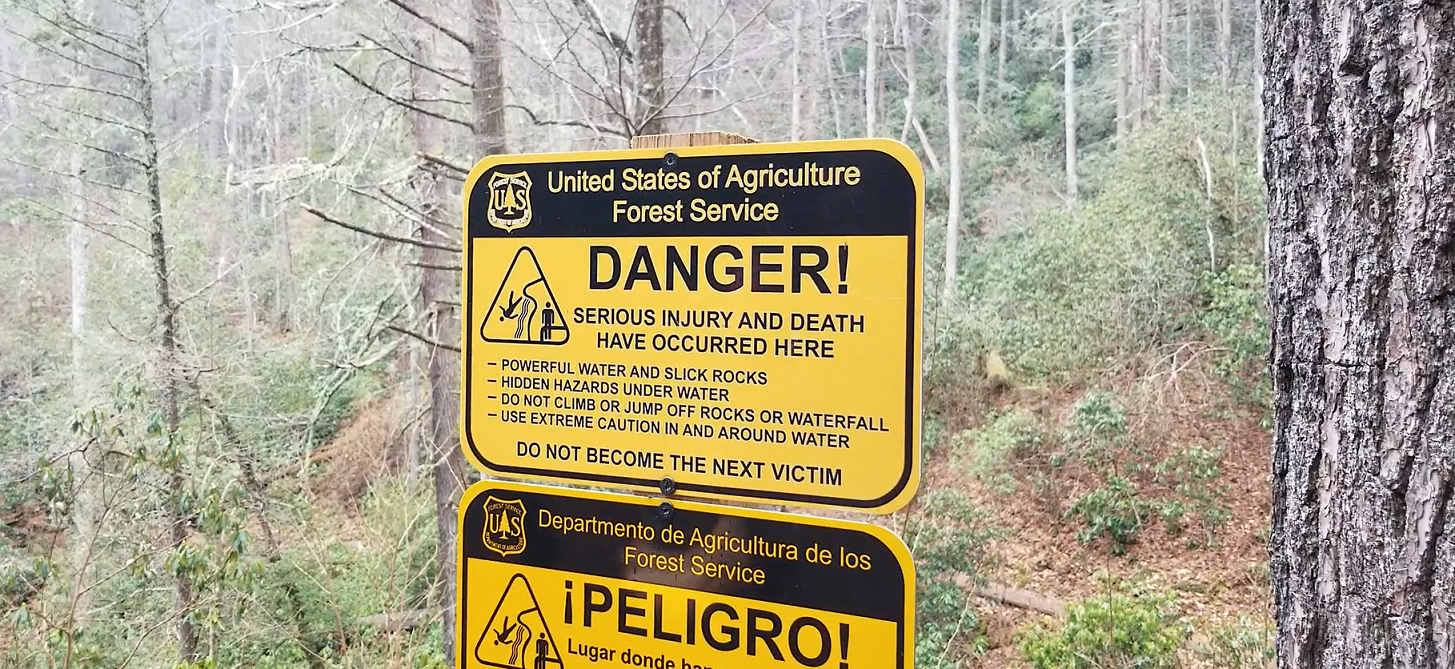
The trail itself is quite easy but the middle tier of the falls is completely open and accessible. Personal experience has shown me that waterfalls are not to be underestimated. The water is moving fast, the rocks are very slick and it's easy to get hurt on them even when being very cautious. I can only imagine that countless people have attempted to venture out onto the rocks and as the sign indicates, it didn't work out to well for many of them.
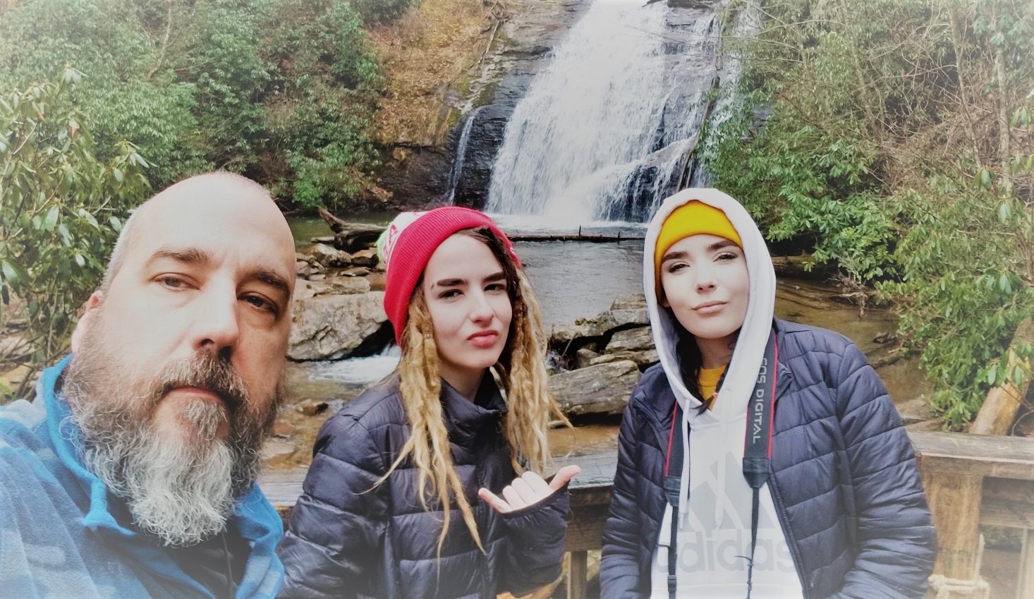
The falls were amazing! We took our time and enjoyed the views. And of course another photo shoot - I called the girls out on that I was quickly informed by both girls that their Instagrams are "Pop'n". I suppose they are right...
Having survived the perils of Helton Creek Falls we returned to the Jeep and continued along the narrow single lane dirt road and across a small water crossing before turning on to Hatchet Creek Road and finally Richard B. Russel highway.

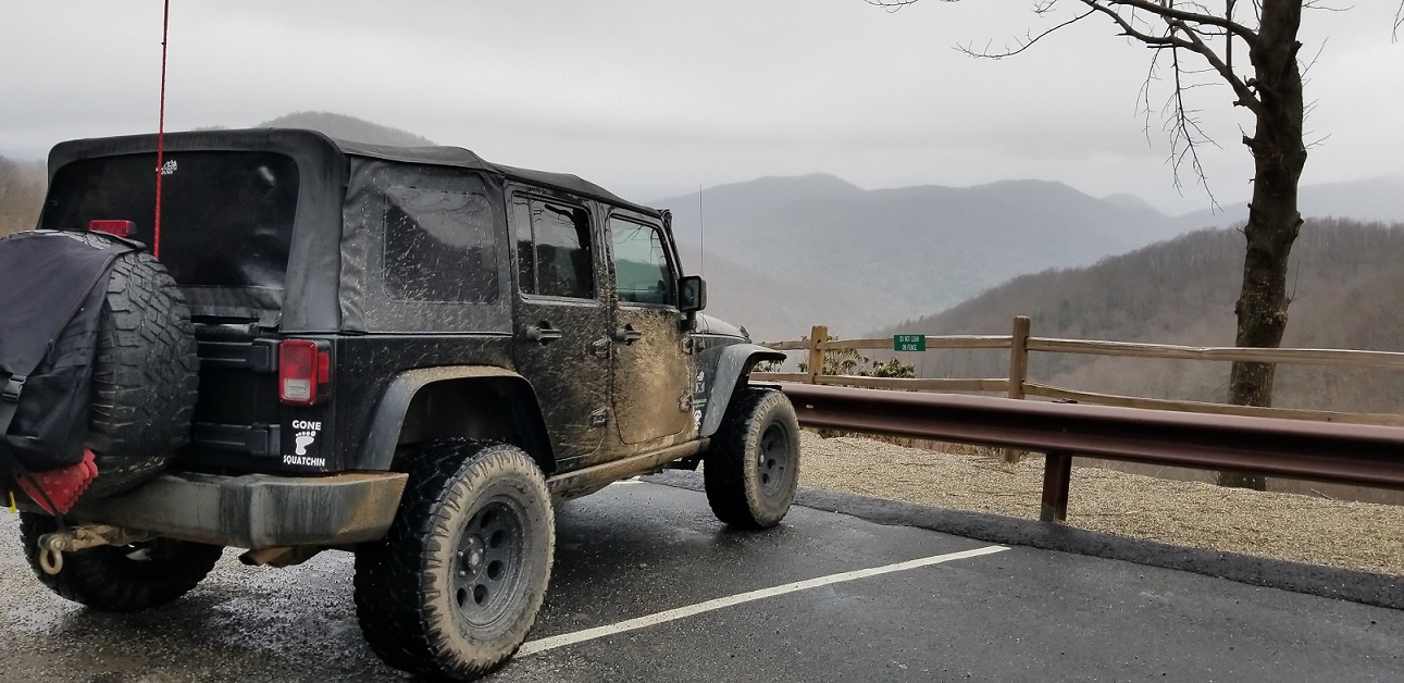
As we continued our journey, the weather varied between a drizzle and a light rain while the temperate continued to drop. The low 40 degree temps at the campsite had dropped to about 31 degrees according to the thermometer in the Jeep. As we headed up the and over the mountain on the highway we were admiring the icicles on the cliffs along the side of the road. Indigo asked if we could stop for some photos just as we came to a spot where there was a small parking area and overlook across from a particularly beautiful wall of icicles.
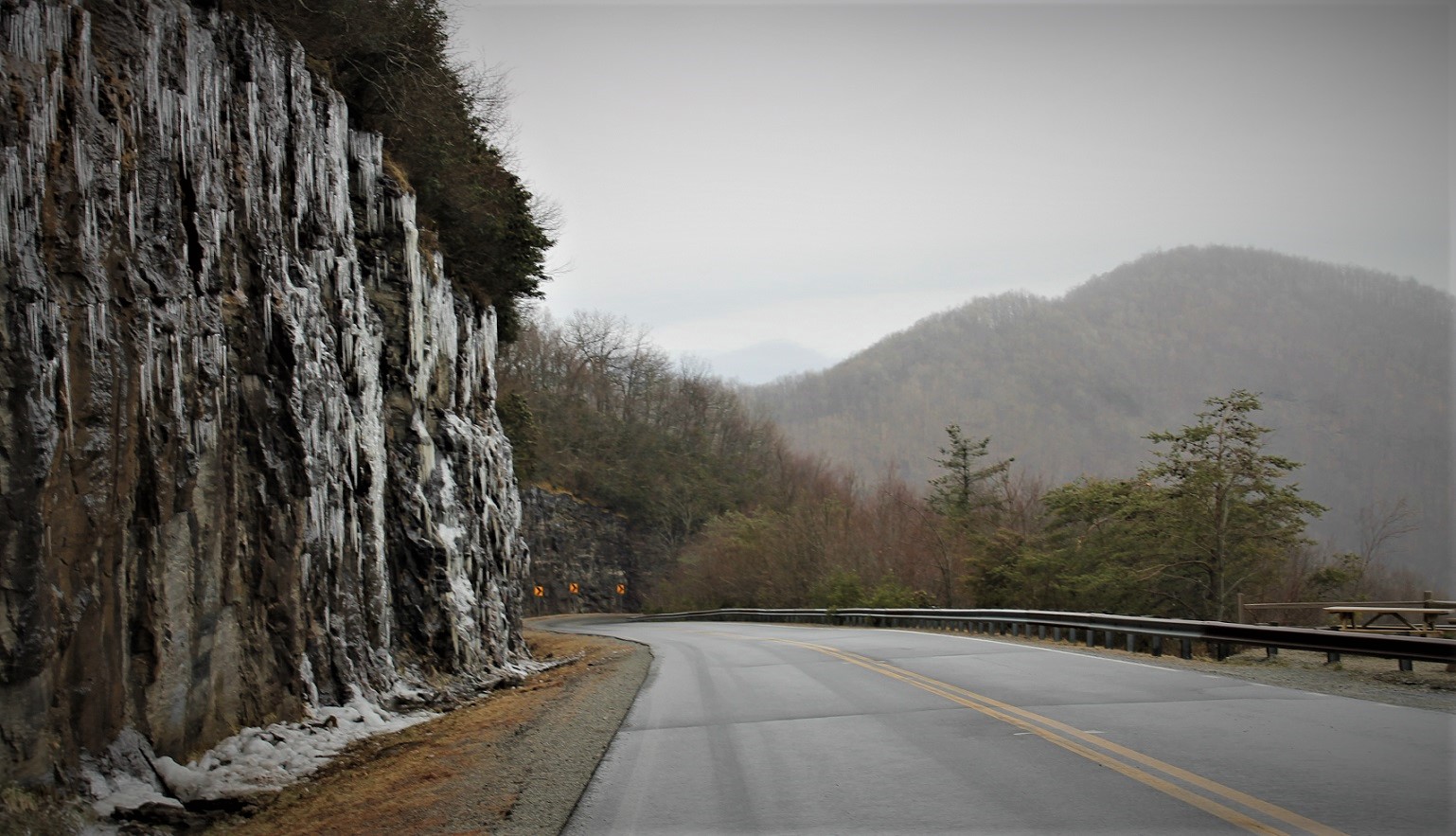
As I turned into a parking spot I felt the Jeep slip a bit. We were on a thin layer of ice. The view from the overlook was stunning but I was more concerned about the ice and really didn't take much time to enjoy it. Indigo hopped out and grab some amazing shots of the 'ice wall' and I shuffled my way up to grab a few pics myself. It was slick. VERY SLICK.
I managed to grab a couple of quick snaps of the Jeep - because that's what Jeepers do best - and started working my way back. I slipped on the ice but managed to catch myself. Then I slipped again and this time was not so lucky. I hit the ground hard and my phone flew from my hands landing a mere 6 inches from the edge of the cliff. Whew! After shaking it off and assessing the damage - just more bruised ego - we loaded up and go back on the road. I kept in in 4HI and took it easy until I was confident there was no more ice.
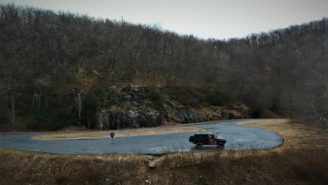
We continued up and over the mountain where we eventually came to another scenic overlook. This was the spot I had been looking for! A clear overlook where I could break out the drone and grab some footage. At this point I had only had the drone for a few days and was still getting a feel for it so I wasn't taking any chances and I didn't fly it out very far. Nonetheless I was able to snag some shots.
By this time we were getting hungry again and even though we had plenty of food with us to cook up a roadside meal 'overlanding style' we decided that it was simply too cold and wet. So we headed for Helen and to The Nacoochee Village Tavern & Pizzeria - a little pizza joint we were introduced to by some friends last year.
When we came to an intersection before turning toward Helen we had to drive around a road sign blocking the way. On the other side we saw that it was a road closed sign and that the highway had been shut down while we were up there. Presumably due to the ice.
It was nice to get indoors for a bit. The pizza shop was warm and the food was good. We drove through downtown Helen but didn't stop and as we now had our sights set on Tray Mountain.
Ok. So before we get started here - YES. I'm aware of the conditions on Tray Mountain but i'm sure some will find an excuse to blast me anyway. Tray is closed and that is a very popular point of contention on the local interwebz. My understanding from a call I made to the forestry last year is that the east side is the point of concern. Arguable the more fun side, the eastern side of Tray is where a very popular campsite and overlook is as well as the infamous 'culvert section'. This refers to the stretch that includes Chimney Mountain Road and Tray Mountain Road up to the intersection of Tray Mountain Road, Corbin Creek Road and the Appalachian Trail.
Our plan was to head up Tray from the western side and take Corbin Creek Road back down the mountain. The forest ranger we passed on our way up the mountain didn't seem to have a problem with this plan either.
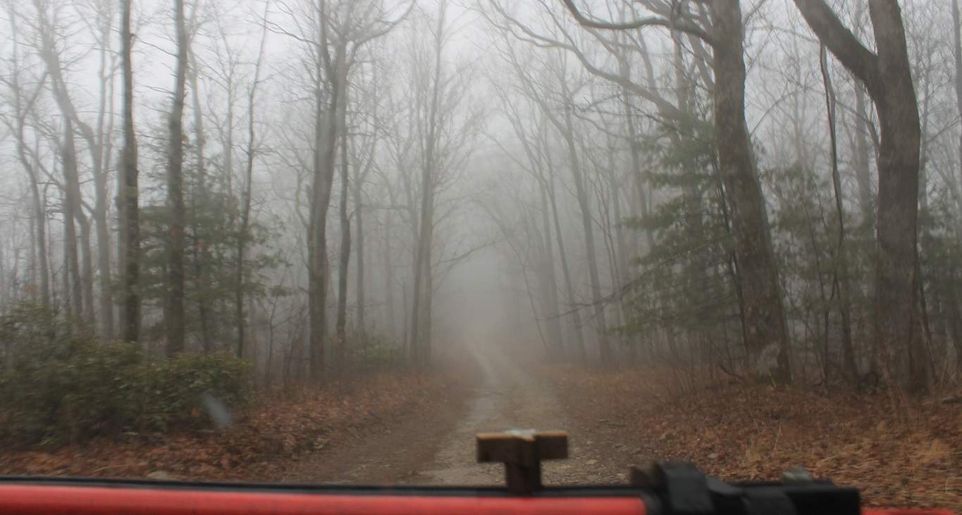
Even though we were not on the better part of Tray the drive was still fun. There was nothing technical about it and only a few rocky spots. The rain continued and as we worked our way up the mountain a heavy fog had set in.
At the confluence of Tray Mountain Road and Corbin Creek Road we discovered yet another closure though not the one we expected. Corbin Creek Road as gated. So once again we found ourselves backtracking after we resisted the temptation to continue along Tray despite the lack of proper signage or gates. We worked our way back to Indian Grave Gap Road and eventually to the Unicoi Turnpike were we called it a day and pointed the Jeep west.
The ride home from Tray was uneventful and we were easily home in time to unload, clean up and catch the mid-season premier of The Walking Dead! The relaxed approach to the weekend was much needed. Nothing dictated our direction or schedule. No timelines, not checkpoints, and no must-sees. Yet despite the lack of a fleshed out plan we still managed to put in 250 miles in the Jeep, bag two peaks by foot, eat some really good food, visited some waterfalls, and take in some spectacular views. If something woke our curiosity we stopped. If it didn't we just kept going. We had everything we needed in the rig so we could pull over and camp where we felt like it. It doesn't get much better than that.
"Life is an adventure, it's not a package tour." - Eckhart Tolle
Follow us on the GRAM and the TUBES!