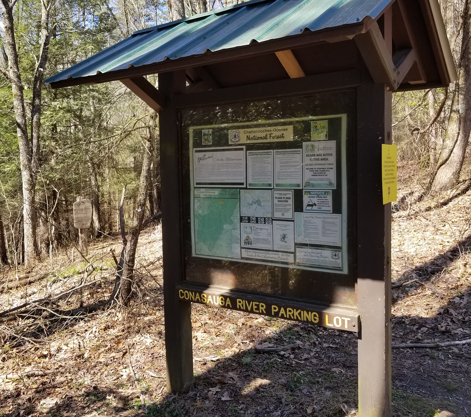
The Cohutta Wilderness
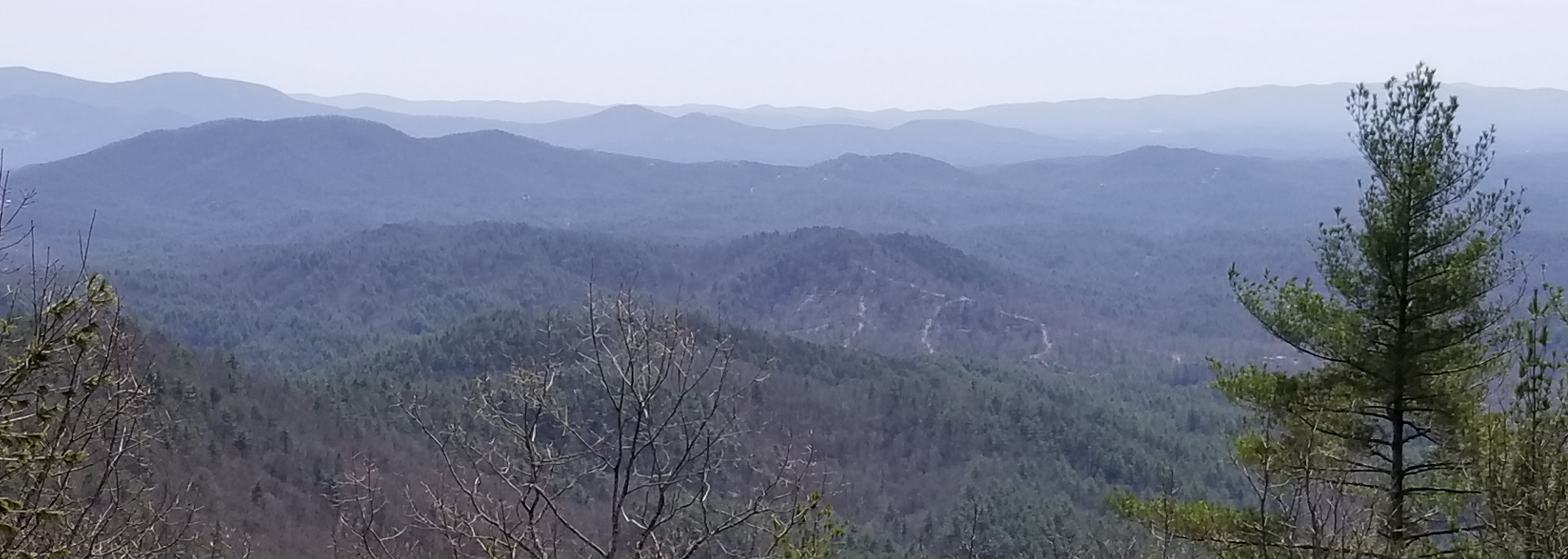
Managed by the Chattahoochee National Forest, the Cohutta Wilderness area is a roughly 38,000 acre forest area that resides in North Georgia between Blue Ridge and Cisco Georgia. It became Georgia’s first congressionally designated wilderness in 1975 and when combined with it’s Tennessee counterpart the Big Frog Wilderness it becomes the largest contiguous national forest area east of the Mississippi.
The Cohutta Wilderness is in the Cohutta Mountains which are part of the Blue Ridge Mountains of the lower Appalachian Mountain Range. The name Cohutta - meaning Shed roof supported by poles - was given to the area by the Cherokee who were the original inhabitants up until they were forced by the Indian Removal Act to leave during what would later become known as the Trail of Tears in 1831.
As was the case with much of the forest areas of the eastern United States, the Cohuttas were heavily logged. Most of the area was owned by the Conasauga River Lumber Company in the early 1900’s which by the 1930’s had cutover nearly three quarters of the area..
 The U.S. Forest Service purchased the land in 1934 and began the rehabilitation process. Due to the congressional designation of “wilderness” in 1975, the area fell under the protection of the of the 1964 Wilderness Act (which serves to protect the “wildlands of America” by prohibiting new road construction, timber harvesting, mechanical transport, and motorized vehicles to name just a few.) The area is designated for primitive recreation activities such as hiking, camping, and horseback riding as well as hunting and fishing.
Trails in the Cohutta Wilderness are maintained to “Primitive Standards” and as such there are no bridges or man-made structures within the wilderness area.
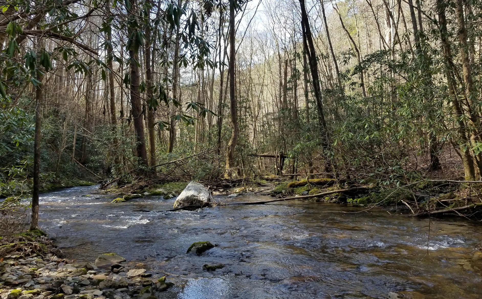
The Conasauga River Trail
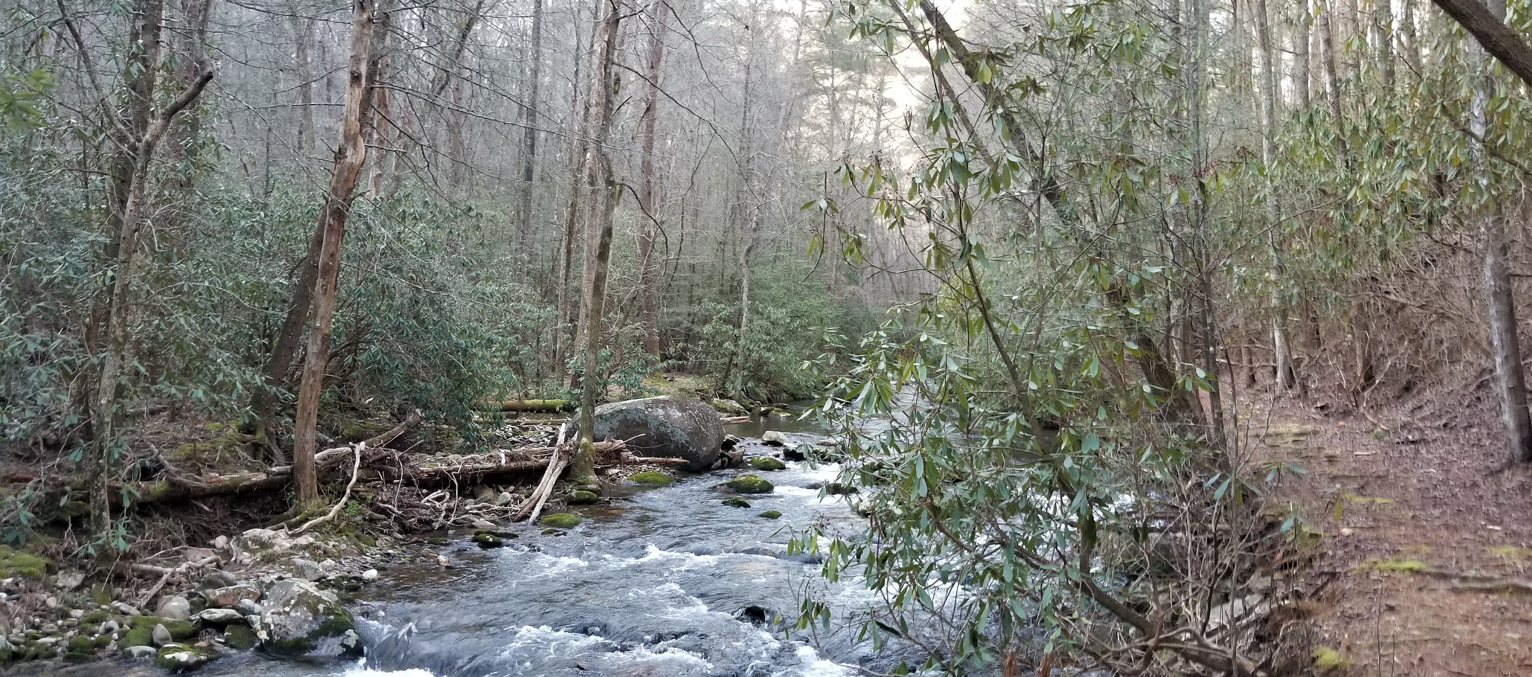
Over all the Cohutta Wilderness contains some 80 miles of hiking trails with the Conasauga River Trail is the second longest at 13.1 miles. As the name implies, the trail closely follows the Conasauga River fording it a total of 38 times along the way. During the period of time when timber was being harvested from the area, railroads were constructed along the Conasauga and Jacks Rivers as a means of transporting lumber. While these railroads have long since been removed the Conasauga River Trail takes advantage of the old trackbed to provide much of its path. Today there is still evidence of the former railroads as the trail passes through rock cutouts and beside stacked stones of former bridge structures.
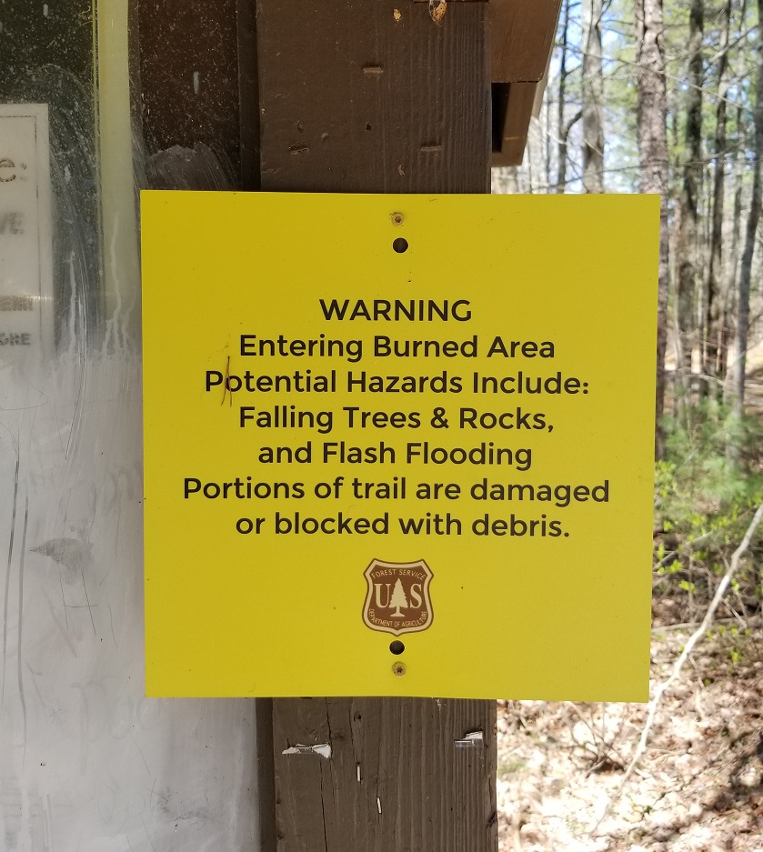
 The Conasauga River Trails is most often hiked from east to west beginning at Betty Gap. Aside from the steep descent from Betty Gap and the steep but shorter grade leaving the trail at the other end, it is mostly level with with only a few small climbs along the way; however, depending on weather conditions and cumulative rainfall the river crossings can become very tricky in spots. Additionally, some sections of the trail have a considerable amount of deadfall trees as a result of the 2016 Rough Ridge Forest Fires.
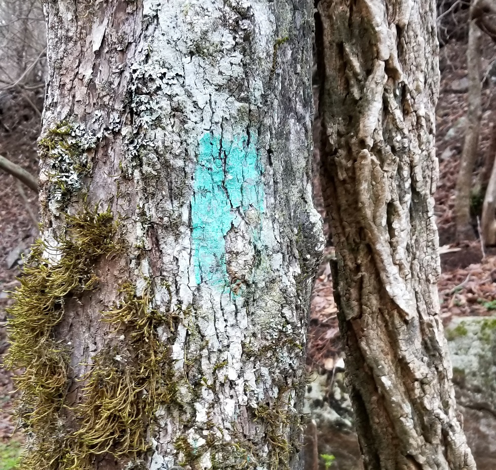 While the trails in the Cohutta Wilderness do use a blaze system, blazes are typically only present at river crossings. The Conasauga River Trail is marked by turquoise blazes that can be somewhat challenging to spot due to lack of maintenance and similar colored flora. In most cases the trail will not cross the river perpendicular but rather in at an angle in the direct of travel. Occasionally when the trail is especially difficult to find other hikers will set up stone cairns to make it easier.
About midway along the trail is an area known as Bray Field. This areas was once the site of a homestead and is now a very popular camping area with several establish sites scattered along the river banks. It is also the junction of the Hickory Creek and Tearbritches Trails with the junction to Panther Creek Trail nearby.
The Rough Ridge Fire
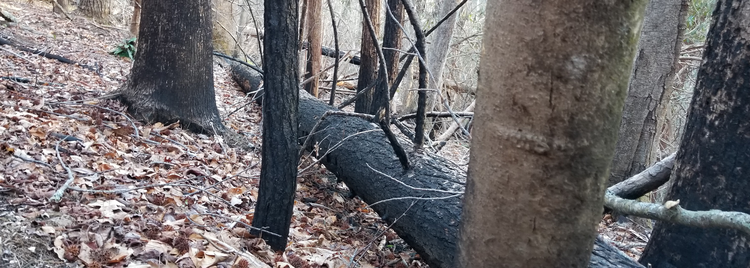
In November 2016 the Rough Ridge Forest Fire claimed nearly 30,000 acres of the the North Georgia Mountains. Because it was believed to have started by natural causes the Forestry Service monitored the situation closely but allowed it to take its natural course. A year and a half later the impact is still very visible along the Conasauga River Trail of the Cohutta Wilderness.
Resources
Cohutta and Big Frog WIlderness Map
https://theforeststore.com/product/cohutta-and-big-frog-wilderness-map/
Hiking Trails of the Cohutta and Big Frog Wildernesses by Tim Homan
http://a.co/2wB4fqy
Excerpt
http://peachtree-online.com/wp-content/uploads/2016/10/HikingTrailsCohuttaexcerpt.pdf
Rough Ridge FIre Incident Report
https://inciweb.nwcg.gov/incident/5078/